博文
RS: how to download MODIS-Aqua Level 2 data
|||
1. Go to NASA Oceancolor Webpage: http://oceancolor.gsfc.nasa.gov/cms/
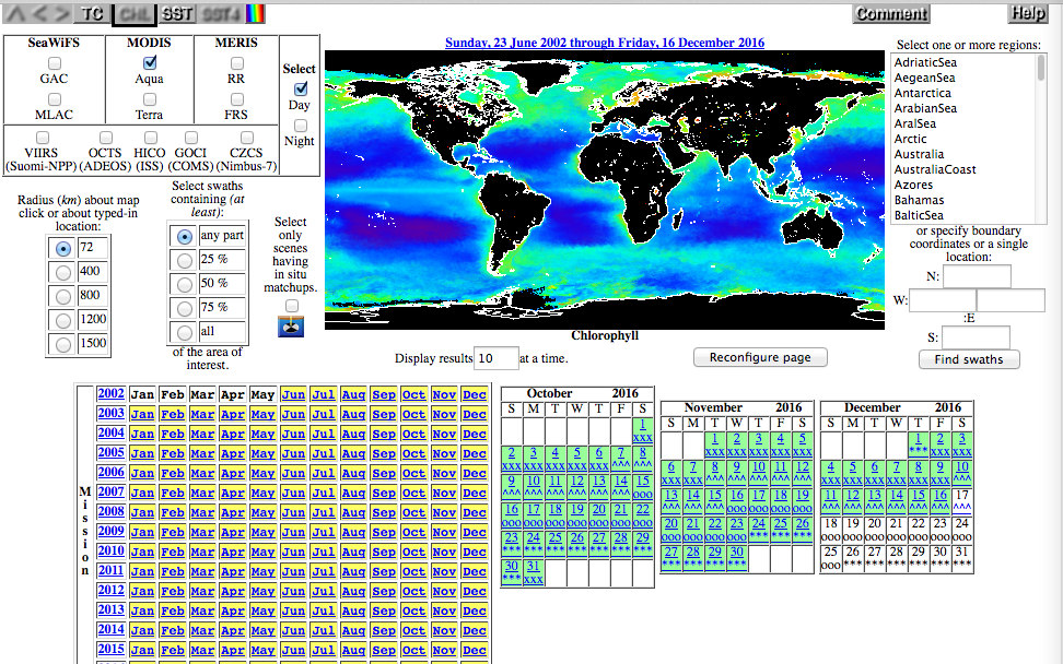
2. DATA -> Data Browsers -> Level 1&2 Browser, and the download screen is displayed with a number of sections (see below pictures):
Top left: sensor dataset selection;
Top middle and right: geographic location selection with a map and some location selectors;
Bottom: date selection with a Year-Month matrix and monthly calendars.
3. Select.
Dataset:
1) The default selection is to have MODIS-Aqua selected. Select any satellite you need.
2) All the other options can remain as their default settings.
3) Click Reconfigure Page. Note: if you donot do this, the webpage will not remember this mission selection as the date and location are chosen.
Date:
Location:
https://wap.sciencenet.cn/blog-3031432-1021019.html
上一篇:Python 2: object.method(arguments)
下一篇:您的博文发表过快,请在xxx秒后再发。